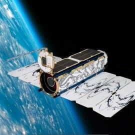
NASA has funded an Arizona State University project to use commercial CubeSat data to determine the presence of water in arid and semiarid rivers in California and Arizona. CubeSats are small satellites, typically the size of a shoebox, that can orbit the Earth and even travel in deep space.
The study, led by sustainability scientist Enrique R. Vivoni of ASU’s School of Earth and Space Exploration and School of Sustainable Engineering and the Built Environment, will provide data and assessments that can assist Southwestern states in their efforts to manage water resources, impose regulations on pollution and maintain water quality in rivers.
Traditionally, approaches for determining water in rivers are conducted using ground-based field surveys that use the presence (or absence) of plant or animal species associated with flowing conditions. These approaches are usually labor- and time-intensive and often limited by access to remote areas.
For this study, Vivoni and Zhaocheng Wang, who is a graduate student in the School of Sustainable Engineering and the Built Environment, developed a new approach to use Earth-observing satellites to detect flowing water in arid rivers. Read more on ASU News.